
Last summer saw us heading North for a few days. We would head to Thurso, round to Dunnet Head and John O Groats following part of the North Coast 500, then down to Dornoch before returning home. Our first stop was Dunnet Head to see both the RSPB reserve and the Chain Home Low radar station and a bunker used by the Royal Observer Corps remains.

Usually a good place to see puffins, guillemots and razorbills we had arrived slightly too late on in the year to see them however we spent time watching fulmars soaring high above the cliffs and gannets skimming low over the water.

A short walk away for the cliffs lies the remains of the Chain Home Low (CHL) radar station. CHL was the name of a British early warning radar system operated by the RAF during World War II. The defences at Dunnet Head were originally built to protect the naval base at Scapa Flow, although during the Cold War a bunker used by the Royal Observer Corps was also constructed.


We left Dunnet Head and along the northern coastline until we arrived at John O’Groats. Lying in the northeastern tip of Britain it is famous as being one end of the longest distance between two points on the British mainland with Lands End in Cornwall being some 876 miles south.
The settlement is said to take its name from Jan de Groot, a Dutchman who once plied a ferry from the Scottish mainland to Orkney, which had recently been acquired from Norway by King James IV. Local legend has that the "o' Groats" refers to John's charge of one groat for use of his ferry, but it actually derives from the Dutch de groot, meaning "the large”. The John o' Groats House Hotel was also said to have been built on or near the site of Jan de Groot's house and was established in 1875. Writing in his1876 book “Haydn’s Dictionary of Dates” Benjamin Vincent wrote:
“John o’ Groat’s House was an ancient house believed to be situated in front of the present hotel and was marked with a flagpole now removed, deriving its name from John of Groat, or Groot, and his brothers, originally from Holland, said to have settled here about 1489. The house was of an octagon shape, being one room, with eight windows and eight doors, to admit eight members of the family; the heads of different branches of it, to prevent their quarrels for precedence at table. Each came in by this contrivance at his own door, and sat at an octagon table, at which, of course, there was no chief place or head.
”

The famous signpost at John O'Groats
Leaving John O'Groats we began to head south towards Wick and the remains of the Old Castle of Wick. Although not much remains of the 11c Castle, the ruins of its four-story tower holds a dramatic perch atop the steep cliff


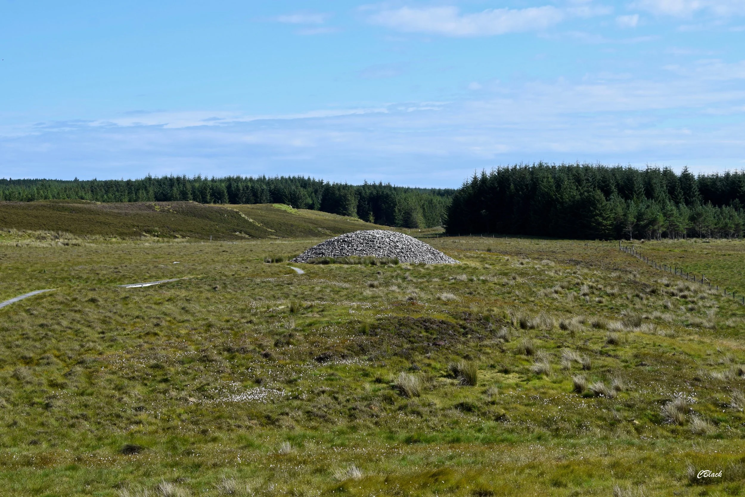
With only a few stops left to go before we retuned home we entered “Flow Country” - 4000 squared kilometres of rolling blanket bog, renowned for being home to a rich variety of wildlife. We arrived at our destination: the Grey Cairns of Camster. We were visiting a one of the earliest Neolithic tombs originally built more than 5,000 years ago. Reconstructed by Historic Scotland the Cairns although beside each other are both different. The monument consists of a long cairn and a round cairn. The long cairn has two internal chambers and the round cairn a single chamber with three compartments.


We joined the A9 as we made our way to our second last stop - a uniquely Scottish building. Between Golspie and Brora, just beside the road, sits the ruins of Carn Liath Broch. Dispite being built in the Iron Age the remains of this broch are still impressive. Its thick stone walls - still 12ft high in places - still hold a well preserved entrance passage and lintelled doorway. In the entrance passage is a cavity possibly used to guard the broch. The broch was first excavated in the 1800s by the Duke of Sutherland, and was initially thought to be a burial cairn. Finds from this excavation included pottery, flint chips, stone hammers, mortars and pestles, querns, whorls, shale rings, long-handled bone combs, a whale bone club, a silver fibula, steatite cups and an iron blade. In 1986 the site was again excavated and this time evidenced suggested that the site was occupied in the Bronze Age, before the broch was built with a Bronze Age cist burial with a food vessel was discovered.


Our final stop of the day saw us arriving at Tollie Red Kites - an RSPB run site providing fantastic close-up views of the stunning birds that are Red Kites

Having never seen Red Kites before I found this the perfect place to start my RSPB100 challenge - you can find out more about this below.
Leaving Tollie, after a good hour watching these birds glide gracefully in the sky, we reflected back on a busy weekend and made plans for our next outing…